


Day Tripping to Monte Carlo, Monaco on a Budget
Get ready to visit a Bond-worthy casino, witness a changing or the guard, and soak in the sea breeze!
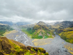
8-Day Iceland Summer Itinerary
A perfect itinerary for eight days exploring Iceland including hotel, restaurant, and excursion recommendations!
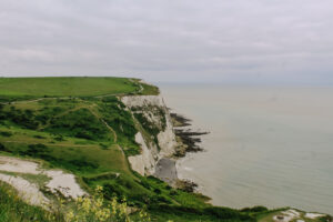
White Cliffs of Dover Day Trip Itinerary
Dover isn’t just cliffs. With stops at a medieval castle, WWII tunnels, and a historical pub, this itinerary offers a little something for everyone.

24-Hour Off-Season Itinerary for Vail, Colorado
Vail may be known for it’s slopes, but there is still plenty to do in the town’s budget-friendly off-season!

Ultimate 3 Day Zion National Park Itinerary
Zion National Park is a stunning and diverse landscape located in southwestern Utah. Read and discover how best to plan your ultimate 3 day itinerary in this magnificent place!
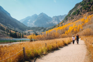
24-Hour Off-Season Itinerary for Independence Pass and Aspen, Colorado
From crossing the infamous Independence Pass to hiking at the Maroon Bells, plan your perfect day trip to Aspen, Colorado!